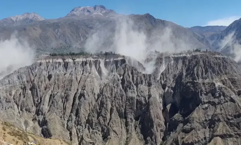
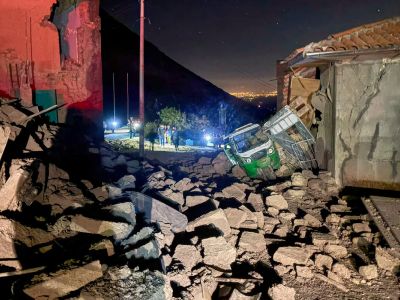
A strong Peru earthquake with a magnitude of 6.7 struck the country’s southern Andes leaving at least two people injured with homes and public infrastructure damaged.
Where Did the Peru Earthquake Strike?
According to the United States Geological Survey (USGS), the earthquake occurred at a depth of approximately 66 kilometres beneath the surface. Its tremor was felt across several areas of southern Peru, including Ica, Arequipa, Huancavelica, Apurimac and Cusco, while residents in the capital, Lima, also felt the shaking.
Why Does Peru Experience So Many Earthquakes?
This is because Peru is located along the Pacific Ring of Fire, one of the world’s most seismically active regions. The country’s location is linked to the movement of tectonic plates, particularly the subduction of the Nazca Plate beneath the South American Plate, which frequently produces seismic activity.
The wider Pacific Ring of Fire is associated with a greater proportion of the world’s earthquakes and volcanic activity.
Peru Experienced Deadly Earthquakes Last Month
This latest earthquake comes about a month after two earthquakes struck Peru’s Junín region in July.
The July 18 earthquakes, which measured 5.1 and 3.7 according to Peru’s National Seismological Center, killed at least six people and injured 21 others, while dozens of homes were destroyed.
Those earthquakes occurred in Chupaca province, around 300 kilometres east of Lima, and were separate from Thursday’s 6.7-magnitude earthquake in the Ayacucho region.
The latest Peru earthquake has prompted assessments across affected communities. Although the earthquake caused injuries and structural damage, there has been no indication of a tsunami from the event.